
A mining operator turned to AUS-ROV to look inside its deep sea tailings placement pipeline, with internal ROV video and 3D laser scanning in a single deployment.
In September 2026, AUS-ROV completed an internal general visual inspection and laser scan survey of a deep sea tailings placement (DSTP) pipeline at a mine site in Papua New Guinea. Working over four days, our team took an ROV carrying cameras and a laser scanner inside the flooded pipeline, building a detailed geometric record of the pipe interior from the surface connection out towards its open subsea end.
The Challenge
A tailings pipeline is critical infrastructure that cannot easily be taken apart or entered. It runs underwater from the shore to deep water, it carries abrasive material, and the owner needs trustworthy information about the inside of the pipe to plan its operation and future inspections. Video alone shows what the pipe looks like, but it cannot measure it.
For this survey the owner wanted both: a visual record of the line along its length, and measured 3D data at selected locations that could serve as a baseline for comparison in the future.
Our Approach
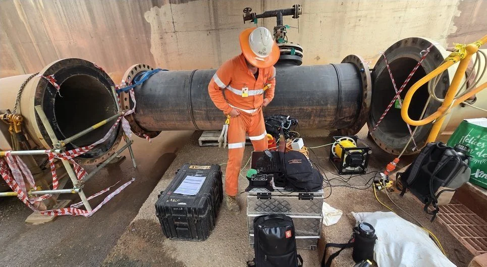
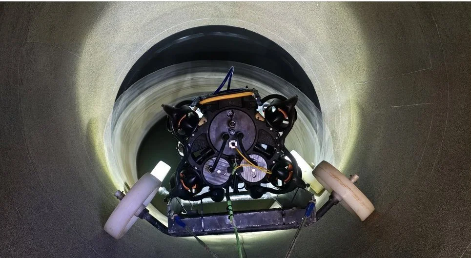
We set up at a barricaded access point at the surface connection and deployed our inspection-class ROV on a purpose-built wheeled skid that carries it along the bore. The ROV travelled the length of the line under remote control while recording high-definition video, stopping at planned locations to run an internal 3D laser scan.
Everything was controlled from a pilot station beside the access point, with a live view of the laser data as each scan was acquired, so the team could confirm good coverage before moving on. Because the vehicle did the work inside the pipe, nobody had to enter it.
Working on an operating mine site meant close coordination with the client's team throughout. Barricading, controlled access to the open pipe end and clear communication between the pilot, the deck crew and the site operators kept the job safe and on schedule.
Each scan location was planned in advance so that the data would be repeatable. Recording the position of every scan along the line means a future survey can return to exactly the same places and compare like with like, which is what turns a one-off inspection into a long-term asset record.
Outcomes and Deliverables
The inspection reached the open end of the pipeline, and internal laser scans were captured at the planned locations along the line. The owner received:
High-definition video of the inspected pipeline.
Calibrated internal 3D laser scan data at each scan location.
A detailed inspection and laser scan report, reviewed and signed off by industry-recognised engineering professionals.
Because the survey was measured rather than only observed, it gives the owner a defined starting point against which later inspections can be compared.
Why It Matters
Pipelines like this one are expensive to build and difficult to reach. A measured internal baseline lets an operator plan maintenance with evidence instead of assumptions, and makes it possible to track change over time. The same combination of ROV video and laser scanning applies to outfalls, intakes, penstocks and tunnels across Australia and the Pacific, wherever water clarity allows laser scanning.
It also reduces risk. Sending a vehicle in place of a person or diver removes the confined-space hazards of a pipeline entry, and a single deployment delivering both video and measured data reduces the time on site and the disruption to the operation.
Planning a similar inspection?
Our ROV tooling reaches places people cannot, and our reports are reviewed and signed off by industry-recognised engineering professionals. We have been operating since 2011. To discuss your pipeline, outfall or tunnel, get in touch:
inspections@aus-rov.com.au | 0412 291 870 | https://www.aus-rov.com.au/contact-us